
Search results
Characteristics
Quick search
489 results
Region
Length
Characteristics
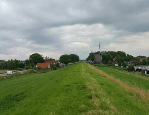

Noorderdijk Route (orange)
From the Wieringerwaard starting point, the Noorderdijk Route (orange) passes Het Polderhuis (1612), the first building in the polder, used as a water board office, police station and town hall. It continues past the impressive water tower (1928) and the mill area, where De Hoop (1742) still stands
6.03 km- (1)
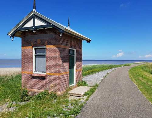

Westerklief Route (yellow)
The Westerklief Route (yellow) initially follows the Dam Route and then crosses to the hamlet of Westerklief. Considering the silver treasures excavated there, this appears to have been a favourite spot of Vikings in around 850-900. You also walk along a stretch of old seaweed dike (the
9.69 km- (13)

Dam Route (blue)
The Dam Route (blue) passes the hamlet of Dam, named after the Korte Afsluitdijk that was built from the mainland to Wieringen in 1924. Via a stretch of Wadden dike (Normerdijk), you come to a curious cross-section of a boulder clay mound: a remnant of the never-completed Zuiderzee railway line
5.86 km- (2)


Postbootroute (red)
The Mail Boat Route (red) passes beaches on the Amstelmeer lake, created after the Amsteldiep was closed off in 1924. Down along the Westerlanderdijk you walk to De Haukes, a charming dike village with an old harbour, where the mail boat (postboot) from the mainland used to dock.
3.64 km- (5)

Nuwendoorn Route (purple)
The purple Nuwendoorn Route runs to ’t Huys te Nuwendore, built on the Zijpe – then a sea inlet – by Count Floris V to guard the dam in the Rekere near Krabbendam. The fortress stood on the Westfriese Omringdijk around 1287, was washed away in 1375 and partly rebuilt in 2011. The route is
11.34 km- (4)
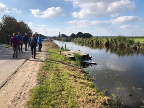

Warmenhuizen Route (green)
The green Warmenhuizen Route is a circular walk through the village, passing the Old Ursulakerk (13th century) and the Roman Catholic Ursulakerk (1873) in the Dorpsstraat, which is also known here as the Oude Wal. The route is waymarked in both directions with green arrows.
3.36 km- (1)

Oostpolder Route (green)
The green Oostpolder Route from Van Ewijcksluis runs around this fertile clay polder, along the Amsteldijk, Oostdijk and Noorddijk. The route is waymarked in both directions with green arrows.
14.15 km- (0)

Oude Veerroute (blue)
The blue Oude Veer Route runs through the Poldertuin and the Kruiszwin to the north-eastern corner of the polder – the village of Van Ewijcksluis on the Balgzand Canal. It then continues along the green Amsteldiepdijk and follows the Lage Oude Veer. The route is waymarked in both directions with
11.65 km- (3)

Nieuwland Route (black)
The black Nieuwland Route partly follows the Stroeërdijk Route, then continues along the eastern ring dyke of the 19th-century Waard-Nieuwland polder. It then runs along the farm track of Jaap and Nils Koorn to Oosterland, Vatrop and the sea dyke. The route is waymarked in both directions with
12.89 km- (0)

Stroeerdijk Route (yellow)
The yellow Stroeërdijk Route runs across the low-lying pastures to the old southern side of Wieringen, where the eelgrass dyke once provided protection against the Zuiderzee. The route is waymarked in both directions with yellow arrows. Parts of the route are not mown frequently.
9.34 km- (2)