Starting point Hargen-Groet


Routes from this starting point
-
LAW Nederlands Kustpad, etappe Groet - Egmond aan Zee
- 20.9km
-
Blauwe route vanaf startpunt Hargen-Groet
- 9.81km
-
Oranje route vanaf startpunt Hargen-Groet
- 6.91km
-
Groene route vanaf startpunt Hargen-Groet
- 9.11km
artikel MAGGS over oranje route Hargen-Groet (1897 kb)
Kaart Startpunt Hargen-Groet 2024 (2071 kb)
At the beginning of the 15th century, Hargen, along with the hamlets of Aagtdorp, Buitenduin, Bregtdorp, Catrijp and Kamp, belonged to the Heerlijkheid Schoorl (the area belonging to the Lord of Schoorl). The Heereweg is the old main route connecting the villages. The Heereweg can be followed throughout Kennemerland over the old beach ridges where people lived to keep out of reach of the water.
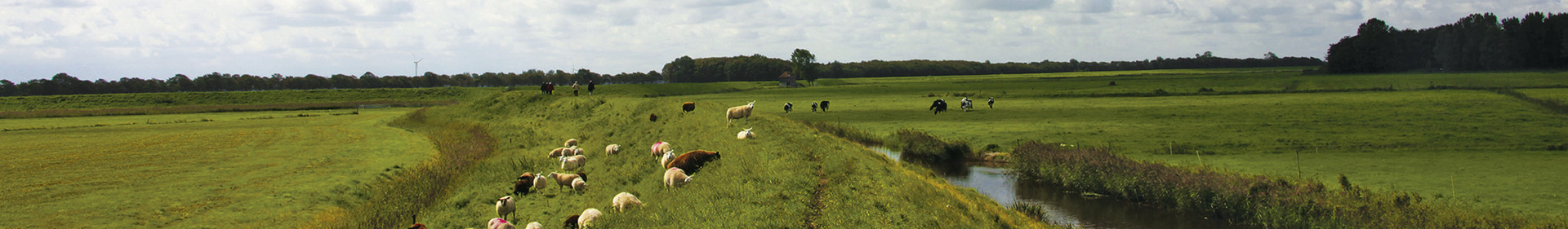
- The Dikes Route (orange) takes you to the 13th-century Oude Schoorlse Sea Dike and the Hondsbossche Slaperdike. The Schoorlse Sea Dike played an important role in keeping the Rekere river out of the inhabited area. The Rekerdam was constructed in the Rekere near Krabbendam in 1264.
- The Grootdammer Polder Route (blue) also brings you to the Oude Schoorlse Sea Dike. You walk past the Groetermolen windmill and towards the Catrijpermoor Nature Reserve. You return via the centre of Groet, a village popular with artists and photographers.
- The Dune and Polder Route (green) combines the medieval Harger en Pettemer polder with a small stretch of the Schoorlse Dunes. The dike is a great place for watching reed and water birds. Harriers regularly hover above the water and you might even hear the call of a bittern.