
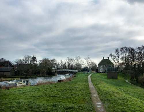
Verlaatroute (purple)
Good
5 Ratings
Rate this route
The purple Verlaat Route runs through the dyke hamlet of Terdiek and past the church ruins to ’t Verlaat, the former lock of Niedorp (now Oude Niedorp). Until 1942, vessels passed through the lock here between the Westerlangereis, a medieval drainage canal, and the old Niedorpervaart, later deepened and widened to form the Alkmaar-Kolhorn Canal. The route is waymarked in both directions with purple arrows.
-
 To add this route in the app: scan the QR code from within the app. or enter the route number 48220 in.
 - 9.44 km
-
 Closed route
-
 Soon-to-be closed route
-
 Reports
-
 Hike point
-
 Starting point
-
 One-way path
Scroll the table below horizontally to see more

| From | To | Segment length | Marking(s) | Characteristics | Reports |
|---|---|---|---|---|---|
|
Starting point de rijd |
0.37 km |
|
|
||
| 0.11 km |
|
|
|||
| 1.07 km |
|
|
|||
| 2 km |
|
|
|||
|
Starting point 't verlaat |
0.93 km |
|
|
||
|
Starting point 't verlaat |
0.5 km |
|
|
||
| 0.26 km |
|
|
|||
| 1.24 km |
|
|
|||
| 1.04 km |
|
|
|||
| 0.68 km |
|
|
|||
| 0.05 km |
|
|
|||
|
Starting point de rijd |
1.2 km |
|
|