
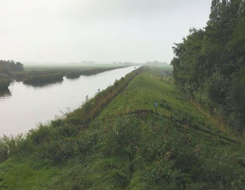
Kromme Gouw Route (purple)
Good
8 Ratings
Rate this route
The purple Kromme Gouw Route runs along an old peat river and a pre-war canal, partly over grass dykes. The farm track is closed between 1 March and 1 July during the bird breeding season. The route is waymarked in both directions with purple arrows.
Note: Some grass dykes on the route can be difficult to walk because they are mown only twice a year. Just before mowing, the grass can be very high. Mowing takes place between 1 June and mid-July and between 1 September and 10 October, to minimise disturbance to nature. Such a rough section lies immediately north of marker 63. If the grass is too high, it is possible to leave or rejoin the dyke about 200 metres north-west of marker 63.
-
 To add this route in the app: scan the QR code from within the app. or enter the route number 56409 in.
 - 7.15 km
-
 Closed route
-
 Soon-to-be closed route
-
 Reports
-
 Hike point
-
 Starting point
-
 One-way path

| From | To | Segment length | Marking(s) | Characteristics | Reports |
|---|---|---|---|---|---|
|
Starting point kolhorn |
0.66 km |
|
|
||
| 0.84 km |
|
|
|||
| 1.89 km |
|
|
|||
| 3.19 km |
|
|
|||
| 0.2 km |
|
|
|||
| 0.27 km |
|
|
|||
|
Starting point kolhorn |
0.09 km |
|
|