
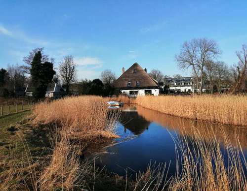
Bergermeer Route (green)
Good
1 Ratings
Rate this route
The Bergermeer Route (green) passes through the Bergermeerpolder and the Loterijlanden. Because of their low-lying position, these hay meadows and pastures are wet. They used to be unpopular with farmers and were allocated annually by lottery. Marsh marigolds and ragged robin grow in the flower-rich grassland, which is also an excellent breeding area for meadow birds. The route also passes a WWII military airfield. On the south-eastern side of the airfield, a pumping station is concealed in the dyke, invisible from the air.
-
 To add this route in the app: scan the QR code from within the app. or enter the route number 349 in.
 - 10.30 km
-
 Closed route
-
 Soon-to-be closed route
-
 Reports
-
 Hike point
-
 Starting point
-
 One-way path
Scroll the table below horizontally to see more

| From | To | Segment length | Marking(s) | Characteristics | Reports |
|---|---|---|---|---|---|
|
Starting point groeneweg |
0.15 km |
|
|
||
| 0.46 km |
|
|
|||
| 0.99 km |
|
|
|||
| 2.19 km |
|
|
|||
|
Starting point viaanse molen |
0.23 km |
|
|
||
|
Starting point viaanse molen |
1.38 km |
|
|
||
| 1.02 km |
|
|
|||
| 3.2 km |
|
|
|||
|
Starting point groeneweg |
0.94 km |
|
|