
Leyduin Route (red)
Unpaved path (partly)
Good
2 Ratings
Rate this route
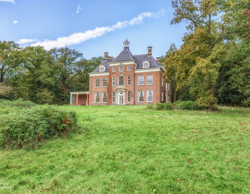
The Leyduin Route (red) north of the village of Vogelenzang leads around the nature-rich estate, including the site where there was a horse racing track at the beginning of the last century, complete with grandstand, gambling office and hotel.
Photo: Westphil Photography
-
 To add this route in the app: scan the QR code from within the app. or enter the route number 189459 in.
 - 4.68 km
-
 Closed route
-
 Soon-to-be closed route
-
 Reports
-
 Hike point
-
 Starting point
-
 One-way path
Scroll the table below horizontally to see more

| From | To | Segment length | Marking(s) | Characteristics | Reports |
|---|---|---|---|---|---|
|
Starting point leyduin vogelenzang |
0.09 km |
|
|
|
|
| 1.35 km |
|
|
|
||
| 1.46 km |
|
|
|
||
| 1.21 km |
|
|
|
||
|
Starting point leyduin vogelenzang |
0.57 km |
|
|
|