
Forts Path (blue)
Unpaved path (partly)
No dogs allowed
Moderate
4 Ratings
Rate this route
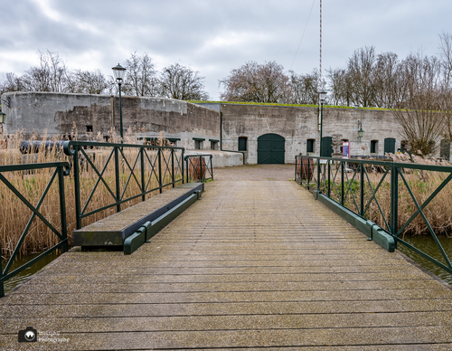
The Fortenpad or Forts Path (blue) runs first along the banks of the Amstel-Drechtkanaal to Vrouwenakker. The route then passes the Fort bij De Kwakel, which was completed in 1897. Of note is the Vuurlijn, a grass dike that was also part of the line of defence. There used to be several batteries here, and the road on the north side was a so-called 'covered community road', outside the range of fire of enemy troops.
-
 To add this route in the app: scan the QR code from within the app. or enter the route number 135252 in.
 - 8.02 km
-
 Closed route
-
 Soon-to-be closed route
-
 Reports
-
 Hike point
-
 Starting point
-
 One-way path
Scroll the table below horizontally to see more

| From | To | Segment length | Marking(s) | Characteristics | Reports |
|---|---|---|---|---|---|
|
Fort aan de drecht starting point (tourist transfer point) |
0.22 km |
|
|
|
|
| 2.39 km |
|
|
|
||
| 1.7 km |
|
|
|
||
| 1.25 km |
|
|
|
||
| 0.81 km |
|
|
|
||
| 0.49 km |
|
|
|
||
|
Fort aan de drecht starting point (tourist transfer point) |
1.16 km |
|
|
|