
Starting Point Nieuwe Niedorp

Routes from this starting point
-
Tramway Route (blue)
- 6.85km
-
Aartswoud Route (green)
- 15km
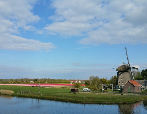
Nieuwe Niedorp owes its charm to the distinctive Dorpsstraat, with its little house bridges and old lock in the Voorsloot; the slightly leaning church tower of 1684; and the former De Roode Eenhoorn inn of 1530. And, of course, to the landmark Westermolen, an eight-sided, internally winding mill built in 1854 in the Oosterpolder. The mill then stood beside Herbergsloot, later re-excavated and widened into the Alkmaar–Kolhorn Canal (1938–1942). According to experts, the name Niedorp or Nijedorp, first recorded in 1206, means Ten-iedorp, or Water Village: die, ie, ij, ee, ae and aa often mean ‘water’ in North Holland. The ‘new village by the water’ was already distinguished from the Old Water Village, some four kilometres to the south. In 1415, the two villages were united under the name Stede Niedorp, but this ‘rural town’ remained a village: a twin village.
- The Tramway Route (blue) runs to neighbouring Winkel, partly along the embankment of the former Schagen–Wognum–Hoorn tramway (1898–1935). The route also follows the grassy dyke beside the canal.
- The Aartswoud Route (green) initially follows the Tramway Route, then turns off at Winkel towards the West Frisian Ring Dyke. Via the Groeterpolder (1847), you follow farm tracks to the sheep-rich grassy dyke beside Groeterkanaal, thanks to the farmers and landowners who open up their land. At Aartswoud, you walk along Groene Pade and beside the Langereis drainage canal.