
Westerduin Route (black)
Great
1 Ratings
Rate this route
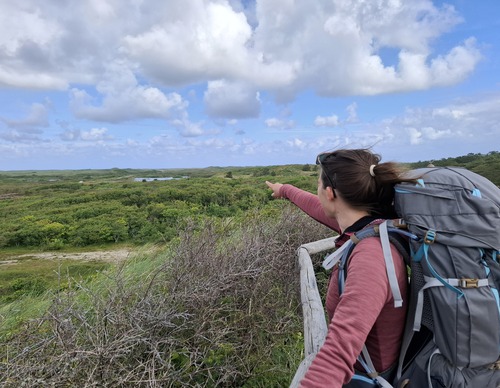
The Westerduin Route (black) is a circular route via the dune edge and the wide beach. The shell path winds through undulating dunes and valleys with burnet roses, a gull colony and, if you’re lucky, you could even spot a hen harrier. Those who climb the Kampeersnol at the end will be rewarded with a panoramic view of the Westerduinen.
-
 To add this route in the app: scan the QR code from within the app. or enter the route number 236749 in.
 - 5.60 km
-
 Closed route
-
 Soon-to-be closed route
-
 Reports
-
 Hike point
-
 Starting point
-
 One-way path
Scroll the table below horizontally to see more

| From | To | Segment length | Marking(s) | Characteristics | Reports |
|---|---|---|---|---|---|
|
Turfveld |
0.67 km |
|
|
||
| 1.84 km |
|
|
|||
| 0.55 km |
|
|
|||
| 0.07 km |
|
|
|||
| 0.43 km |
|
|
|||
|
Turfveld |
0.94 km |
|
|