
Rode route vanaf startpunt Callantsoog
Good
13 Ratings
Rate this route
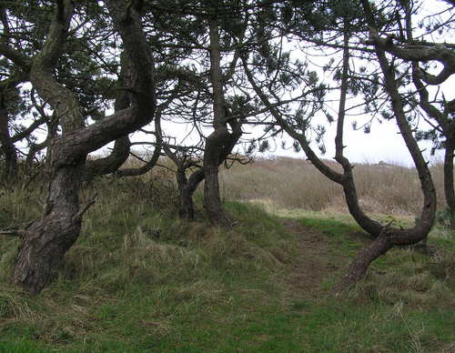
The red route runs through the Uitlandsche Polder, formerly known as Uytterlandt, passing low dune mounds and wet, low-nutrient grassland. Natuurmonumenten (Society for Nature Monuments) created this nature area in 2014. Cattle graze on the Uitlandsche Polder from June to September. The route then passes the overgrown Zijperzeedijk and runs to the Luttickduin and the Heinollen.
At marker 38, it is possible to cross the road to Het Zwanenwater, managed by Natuurmonumenten. The walk can be extended here by choosing one of the marked routes: the yellow route (2 km) or the brown route (4.5 km). Entry to Het Zwanenwater is free for members of Natuurmonumenten. Non-members can purchase a day ticket from the ticket machine at the entrance.
-
 To add this route in the app: scan the QR code from within the app. or enter the route number 2505 in.
 - 6.30 km
-
 Closed route
-
 Soon-to-be closed route
-
 Reports
-
 Hike point
-
 Starting point
-
 One-way path

| From | To | Segment length | Marking(s) | Characteristics | Reports |
|---|---|---|---|---|---|
|
Starting point callantsoog |
0.12 km |
|
|
||
| 0.61 km |
|
|
|||
| 0.51 km |
|
|
|||
| 0.49 km |
|
|
|||
| 0.32 km |
|
|
|||
| 0.05 km |
|
|
|||
| 0.77 km |
|
|
|||
| 1.11 km |
|
|
|||
| 1.43 km |
|
|
|||
| 0.57 km |
|
|
|||
|
Starting point callantsoog |
0.33 km |
|
|