
Lighthouse Route (blue)
Rate this route
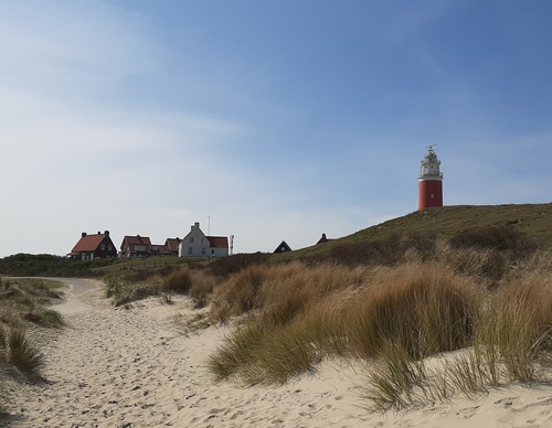
The Lighthouse Route (blue) runs through the Eierlandse Dunes and over a wide beach to the lighthouse. The fields along the path are called the Tuintjes (gardens) because they used to be the gardens of the lighthouse keepers. Just before the transition from dune to beach, you pass an observation point with great views. During the breeding season, part of the beach is cordoned off to give beach-nesting birds such as the common ringed plover some peace and quiet. You can easily walk around it but please keep your dog on a leash.
-
 To add this route in the app: scan the QR code from within the app. or enter the route number 236751 in.
 - 3.59 km
-
 Closed route
-
 Soon-to-be closed route
-
 Reports
-
 Hike point
-
 Starting point
-
 One-way path
Scroll the table below horizontally to see more

| From | To | Segment length | Marking(s) | Characteristics | Reports |
|---|---|---|---|---|---|
|
Vuurtoren |
0.1 km |
|
|
||
| 0.56 km |
|
|
|||
| 0.31 km |
|
|
|||
| 0.1 km |
|
|
|||
| 1.46 km |
|
|
|||
| 0.97 km |
|
|
|||
|
Vuurtoren |
0.1 km |
|
|