
Mill Network Route (red)
Unpaved path (partly)
No dogs allowed
Rate this route
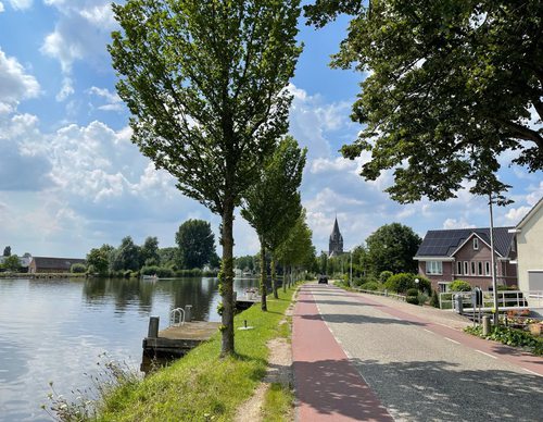
The Molengangroute or Mill Network Route (red) passes through the polderland north of the village. Via the ring dike you walk to where three mill networks used to drain onto the higher grounds. One mill stump has been preserved from the mill complex. Please note that dogs are not allowed and the route is not accessible during the breeding season.
-
 To add this route in the app: scan the QR code from within the app. or enter the route number 135247 in.
 - 6.26 km
-
 Closed route
-
 Soon-to-be closed route
-
 Reports
-
 Hike point
-
 Starting point
-
 One-way path
Scroll the table below horizontally to see more

| From | To | Segment length | Marking(s) | Characteristics | Reports |
|---|---|---|---|---|---|
|
Nes aan de amstel starting point (tourist transfer point) |
0.59 km |
|
|
|
|
| 1.37 km |
|
|
|
||
| 0.79 km |
|
|
|
||
| 1.33 km |
|
|
|
||
| 0.21 km |
|
|
|
||
| 1.8 km |
|
|
|
||
|
Nes aan de amstel starting point (tourist transfer point) |
0.18 km |
|
|
|