Starting point Station Santpoort-Zuid (tourist transfer point)
Routes from this starting point
- Duinlust Route (orange)
- 6.58 km
- Meer en Berg Walk (yellow)
- 2.81 km
- Slaperdijk Route (blue)
- 7.95 km
- Spaarnberg Route (red)
- 5.68 km
- nf link
- 7.38 km
Santpoort-Zuid is located at the inland dune region. To the north is the Burgemeester Rijkenspark, a green remnant of Buitenplaats Spaarnberg: a former linen bleaching house that was transformed into a romantic estate by the famous garden architect Zocher at the beginning of the 19th century. The routes from this station string together the dunes, the leafy residential districts and the polder area.
- The Meer en Berg Walk (yellow) is a short circuit over the grounds of the former psychiatric clinic at Santpoort-Zuid. You walk through a spacious, new park.
- The Spaarnberg Route (red) goes through the Burgemeester Rijkenspark in Santpoort-Zuid, named after Roelf Gerrit Rijkens, a former mayor of Velsen (1920-1932). West of the track are the ruins of the medieval Brederode Castle. The ruins can be visited. For opening hours, go to www.ruinevanbrederode.nl. The terrace of the former outer bailey it is good spot to relax.
- The Duinlust Route (orange) connects Santpoort-Zuid with Bloemendaal. You will see elegant residential areas along with the Meertje van Caprera lake, the Bloemendaalse Bos forest and the Duinlust park.
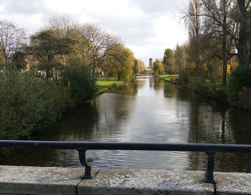
- The Slaperdijk Route (blue) from TOP Santpoort-Zuid connects the inland dune edge with the outskirts of Spaarndam and the two forts of the Defence Line of Amsterdam. You walk along the Jan Gijzenvaart canal, dug in 1537, and the vast polder landscape of Spaarnwoude. The Hekslootpolder served as a firing range of the Defence Line of Amsterdam and was not allowed to be built on. Now lapwings, godwits, geese and Eurasian coots settle here. You return to the station along the old Slaperdijk, which used to hold back the water.
© OpenStreetMap contributors